Features
Fruit
Production
Ontario vineyard mapping
Info base could open up many more web “rooms”
April 15, 2008 By Jim Meyers
By now, all Ontario grape growers
should be able to ramp up onto the information highway joining other
farm commodity groups, like soybean growers, that are already using
geographic information system (GIS) mapping for global positioning
system (GPS) satellite retrieval of crop information.
Info base could open up many more web “rooms”
By now, all Ontario grape growers should be able to ramp up onto the information highway joining other farm commodity groups, like soybean growers, that are already using geographic information system (GIS) mapping for global positioning system (GPS) satellite retrieval of crop information.
 |
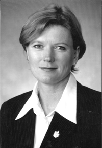
| Debbie Zimmerman |
 |
| Gerry Walker |
The first growers went online when the project was officially announced at the Grape Growers’ of Ontario (GGO) annual “state of the industry” address at the end of March. Last year, 300 of Ontario’s 530 growers had their vineyards GPS mapped. The mapping continued this year, totalling some 16,000 acres in the Niagara, Prince Edward County, and Lake Erie north shore grape growing areas.
It’s a base of information that will be annually updated and additional website “rooms” (components) added to assist growers, wineries, and eventually the public. In one future “room,” wine lovers can not only trace the vineyard origin of their favourite bottle of Ontario wine, but also a grower’s management practices through a computer bar code on the bottle, project manager Gerry Walker said.
For 15 years he was the delivery person for the tender fruit and grape integrated pest management program at Vineland Station. Now he’s delivering the mapping program to growers through the business development arm of Ontario’s AGRICORP farm agency that also administers the federal/provincial crop insurance program.
Expands on B.C.’s research program
“It’s only a vision,” he said about the consumer arm of the mapping program. “It would depend on consumer demand and how transparent growers and wineries want to be.”
But it would address the “government and consumer demands for safe, quality food and drink,” phraseology that’s in an information handout on the program. And while it’s not a first in Canada, it’s a step beyond what’s been a university research project in British Columbia to a practical application in Ontario.
“It means going web-live and the industry going online to get aggregate information,” Walker said about sharing information while also keeping each grower’s information private and
confidential.
The mapping is being promoted as a management tool for growers and great care has been taken to protect individual growers who access the system through a personal code. Growers will talk among themselves and pass on new techniques they may learn, Walker believes.
“In order for growers to be comfortable sharing information, they have to be assured it is secure,” he said. “They may not want (others) to know about new, untested varieties they’ve planted because they want to be five to 10 years ahead of the industry,” he said.
“If we already had a five-year record to include wind machines, we could overlay that information to determine if they are benefit to the industry,” Walker said about the increasing interest in the windmill-like machines that move heated air in vineyards.
The GGO applied for and received $250,000 in federal funding to launch the project, delivered through the provincially administered Agricultural Adaptation Council (AAC). AGRICORP’s contribution is the fieldwork, estimated to be worth $200,000 in the start-up phase, and the marketing board contributed some $80,000. Additional in-kind professional services runs the total to around $750,000, Walker said.
“Since we are the ones who initiated the project, we’ll likely be responsible for keeping it running,” GGO chairman Ray Duc said. In that way, it will be much like the chain of on-farm weather stations in Niagara that were paid for with money from the grape pullout program that was negotiated with the Canada/U.S. free trade agreement.
Possible crop insurance use
Over time, a historical bank of information will provide valuable information that growers can use to compare their own production to aggregate data. The information can be used by growers to develop long-term strategy and for the marketing board to be armed with up-to-date information for its annual price negotiations with wineries represented by the Wine Council of Ontario. At this time, the WCO isn’t directly involved in the program but could be in Phase 2, which has computerized weigh billing. With a historical information base, growers and wineries will be better able to estimate tonnage and quality.
Linda Franklin, WCO executive director, said there could be uses down the road. “It’s like when we first got a fax machine in the office and no one knew how to use it,” she said.
And it’s technology that AGRICORP could eventually use to more accurately define categories to set rates for crop insurance coverage. A number of growers have complained the categories now are too broad so that those with hardier varieties are paying higher premiums to support the crops losses of growers with less hardy varieties planted in areas prone to frost and winter injury.
Ongoing computer training offered by the GGO is helping members embark on this brave new world of farm management technology.
“(It) will accomplish in a few short years what has taken the French centuries to determine using traditional methods,” Debbie Zimmerman, CEO of the GGO, said earlier this year.
Print this page